|
- Mt Hinata, situated in the western part of Yamanashi Prefecture and the north-east of Mt Kaikoma is a Mecca of hiking. A part of the top, called Gangahara (prairie of geese) is covered with white sands caused by a break-down of granite rocks: you will even feel dazzled if you climb their in a fine day. Mt Yatsu is seen big, crossing over the valley where JR-Chuo railroad and Chuo Expressway go through.
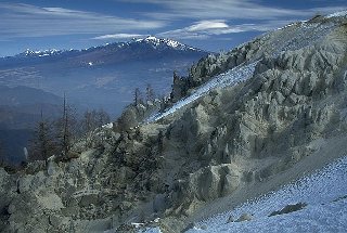
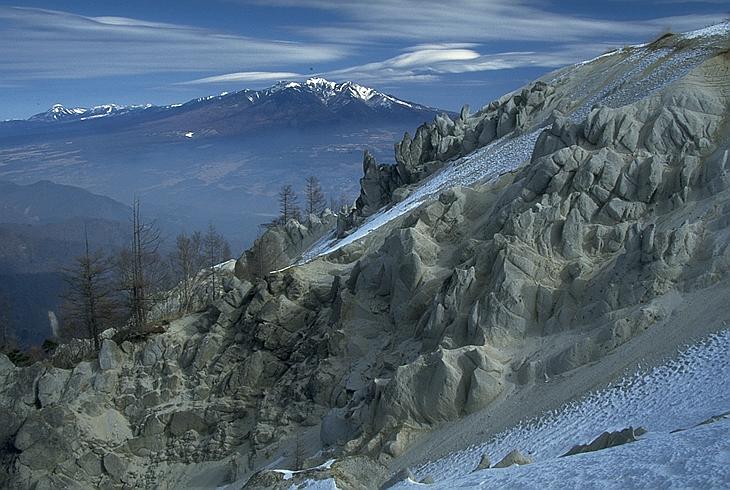
- Mt Yatsu is a group of volcanos situated between the east of Nagano Prefecture and the north of Yamanashi Prefecture and streching over 20km from east to west. Its highest peak is Mt Akadake of 2899m high. According to a legend, once upon a time, Mt Yatsu (male) and Mt Fuji (female) would have disputed over their height. Realized that she is lower than Mt Yatsu, Mt Fuji would have given a foot kick to his head. It is why his summit has been split to several peaks.
- 2530m high, Mt Tateshina is a volcano located at the center of Nagano Prefecture and a northern continuation of Mt Yatsu. The peak is formed from a lava dome of andesite laid over a strato-volcano. On the south-west skirt, also called Tateshina Highland, there exists Tateshina Spa and to the west Lake Shirakaba and Mt Kiri continue. In winter, you can enjoy winter sports such as ski and skate.
- The huge mountain skirt which is formed from pumice and mud flows owns many prehistoric remains, especially those of Jomon Period like Togari-ishi in Chino City and Idojiri in Fujimi Town. The western skirt would have been worshipped as a holly prairie and not cultivated until the Middle Ages.
|
 Japanese display
 French display

